What if I told you that, even over the busy July 4th weekend, there is a place in Texas where you can turn up and camp – without making a reservation – at a near-empty campsite in a pristine mountain wilderness, with an 80-mile network of lightly trafficked, breathtakingly gorgeous hiking trails starting just a stone’s throw from your tent?
As unlikely as it may sound, there is such a place – Dog Canyon, located in the Guadalupe Mountains National Park. The downside is that this Utopia is nearly 800 miles from Houston, putting it out of reach for anything less than a 4-day weekend or for anyone unprepared to do a serious amount of driving.
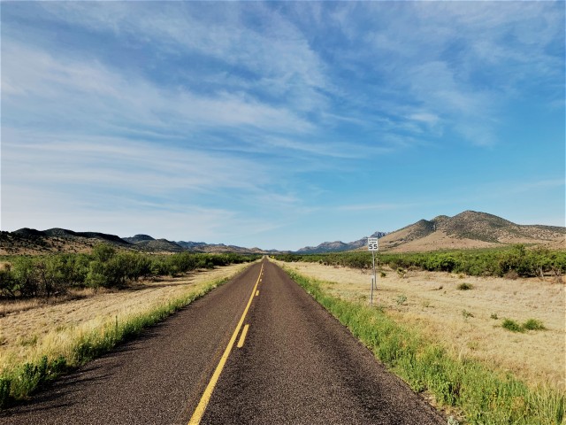
In essence, you drive to an already very remote spot – Carlsbad Caverns in New Mexico – then take a 60-mile dead-end road that loops around the northern edge of the Guadalupe Mountains and at the last minute – two hundred yards before the end of the road – sneaks back into Texas.

At Dog Canyon, I was able to combine five of the things I like most: birding, exercise, remote places, long road trips, and being alone. And I don’t care if I sound antisocial – this really was a wonderful experience.
Day One:
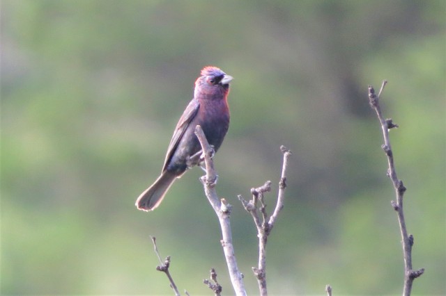
I left Houston at lunchtime on Wednesday and headed west, arriving late afternoon at a targeted stop for Varied Bunting. Easter Pageant Hill is located just off i-10 at Junction, in Kimble county, some 300 miles west of Houston. With temperatures still in the high 90s, I wasn’t expecting a miracle, but literally one of the first birds I laid eyes on was a handsome male Varied Bunting singing its heart out from the top of a small tree. This completed my sweep of all 4 buntings (Painted, Indigo, Lazuli, and Varied) in Kimble county in 2019.
With a quicker-than-expected result here, I aimed high and decided to try and make the Fort Lancaster rest area before nightfall. This remote spot near Sheffield is a renowned location for the very local Gray Vireo – indeed, it is the only place I have ever seen this species. The sun was already dipping close to the horizon when I arrived at the site, but my luck continued; I soon heard and briefly saw two Gray Vireos here at this picturesque canyon, with the surprise appearance of a flock of Bushtits an unexpected bonus.
I considered sleeping in my car overnight here, which I have done before at this location, but I was feeling full of energy after my success with the birds, so I continued on the long road west.
One thing about car camping in Texas in July is that it is HOT, and my plan was to aim for higher altitudes where the weather was hopefully a little cooler. It was just before midnight when I arrived at the Lawrence Wood picnic area on a remote road in the Davis Mountains, a spooky place in the woods with literally no passing traffic all night, but thankfully, cool temperatures allowing a relaxing night’s sleep in the car.
Day Two:

I awoke before dawn hoping to hear a Western Screech-owl or Mexican Whip-poor-will, but I was out of luck with the night birds here. Daybreak, however, produced a slew of good sightings at this excellent spot, including first-of-the-year Plumbeous Vireo, Western Bluebird, Gray Flycatcher, Hepatic Tanager, Canyon Towhee and Black-headed Grosbeak – which are all common birds in the mountains of west Texas but rare or absent further east. A Hutton’s Vireo was also a year tick and an excellent bonus bird, one which I knew I would be very unlikely to see in the Guadalupe Mountains.
I then wasted some time trying to find Lucy’s Warbler at an out-of-range location near Van Horn where a pair had been seen on territory earlier in the season. When I finally arrived at Van Horn a little later, I was dismayed to discover that I was still 170 miles – a 3-hour drive – from my final destination. It was starting to dawn on me that Dog Canyon is a seriously remote place!
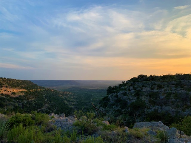
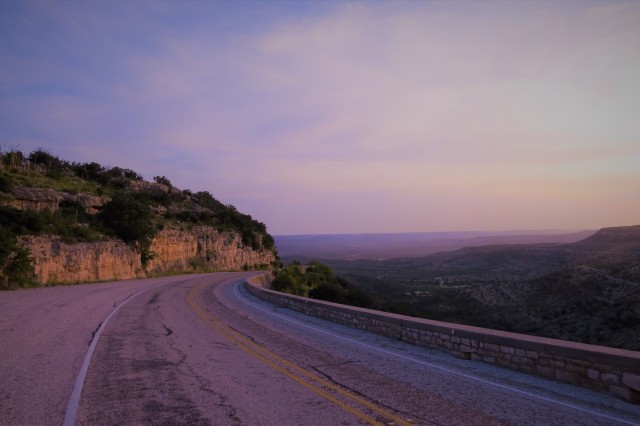
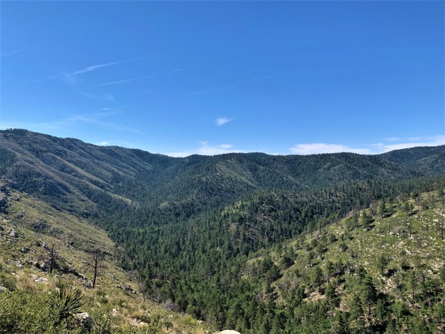
I wasn’t complaining about the scenery, though, with the road from Van Horn passing through expansive deserts before climbing up into the Guadalupe Mountains, then crossing over into New Mexico. Dog Canyon is at the far northern end of the Guadalupe Mountains National Park, a two hour journey by road from the national park headquarters at Pine Springs, or a full day’s hike.
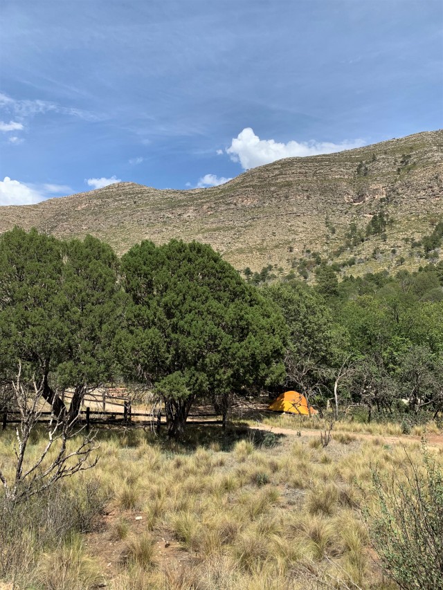
I was getting a little nervous as I neared Dog Canyon, because there are just 9 campsites. Reservations cannot be made – the sites are allocated on a “first come first served” basis – and I suspected that the July 4th week would be one of their busiest times of year. However, I needn’t have worried, as I was literally the first person to arrive (although perhaps 5 other campsites were occupied later).
Dog Canyon is a perfect spot; each site is equipped with a camping “pad” and picnic table, and with my pick of all the sites I could select the most shaded one. There is a bathroom with sink and flushing toilet but no shower (although taking a “stand-up” shower at the sink is straightforward enough).
I wandered around the campsite area for the rest of the afternoon, but the weather was unusually hot – even up here at 6,000 feet above sea level – and I didn’t see many birds.

Day Three:
I am reliably informed that the best way to truly relax on vacation is to have no idea what the time is. Dog Canyon is a great place to follow this philosophy – most of Texas (apart from the far western tip near El Paso) lies in the Central time zone, whereas New Mexico is on Mountain Time, one hour behind. By the time I had driven up from Van Horn, cut through New Mexico, and dropped back into the very edge of Texas again, my phone (and me) were both thoroughly confused. My car clock also changes automatically with time zones, so I had no help there either. I set my alarm super-early to make 100% sure I was up and about before sunrise – which turned out to be a good move because the first thing I heard as I awoke was a Common Poorwill calling from a rocky slope near the campsite.
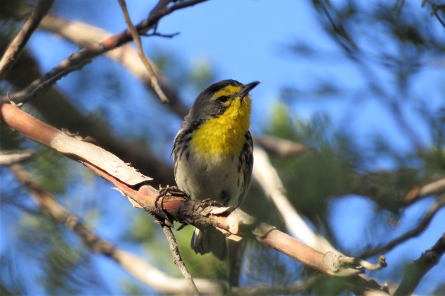
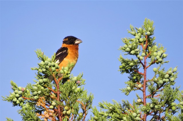
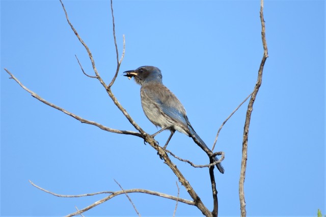
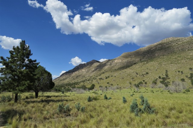
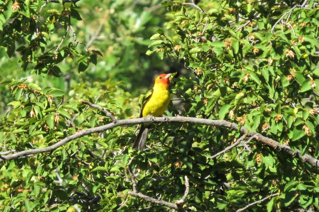
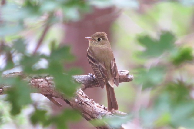
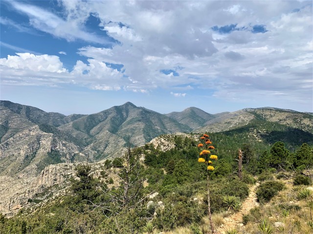
Loading plenty of food and water into my day pack, I set off on the Tejas Trail up Dog Canyon. I had received some great advice from other birders that the best way to find birds here is by walking in the bed of the canyon itself, not on the trail along the edge. This worked out well, and by the time I had reached the “switchbacks” further up the canyon, I had already amassed a great list including Black-throated Gray and Grace’s Warblers, Cordilleran and Gray Flycatchers, Broad-tailed Hummingbird, Mountain Chickadee, and plenty of Western Tanagers and Black-chinned Sparrows.
This single-track trail then passes through some open, exposed areas, where the birds were fewer in number but a Zone-tailed Hawk passed overhead. After passing the intersection with the McKittrick Canyon trail, at around 7,700 feet altitude, the Tejas Trail gradually enters forested areas once again; some high-altitude pine forest birds such as Steller’s Jay, Hairy Woodpecker and Dark-eyed Junco began making appearances along here. I got as far as the Tejas Camp, around 7 miles from my starting point, before turning around and retracing my steps back to Dog Canyon for a total day hike of just over 14 miles and an elevation gain of around 2,000 feet.
By the time I turned around, it was already early afternoon, and at this altitude the sun is very strong. In remote areas like this, it pays to be hyper-aware of things like drinking water, sun exposure, and exhaustion levels – especially considering that I was totally, utterly and completely alone; I saw not a single person on the trails all day. For some, this would be alarming; for me, it was inspiring and wonderful. We get so few chances to be alone in our busy lives.
I was also constantly aware of the potential threat posed by bears and especially Mountain Lions, both of which inhabit the Guadalupe Mountains in good numbers. I would have loved to encounter either one of those – at a safe distance, of course! – and I spent some time scanning distant ridges and slopes but to no avail.
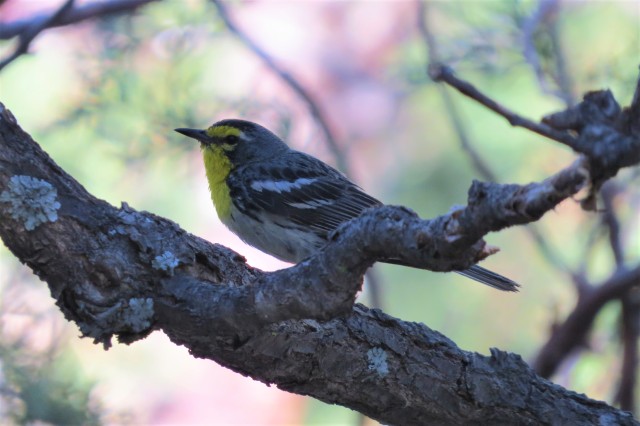
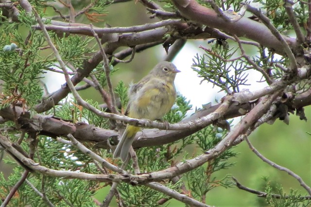
The birding was still good on the way back, even in mid-afternoon, and the highlight was discovering a family party of Virginia’s Warblers near the top of Dog Canyon – a life bird for me and one of the main targets of my trip.
Day Four:
Having cleaned up on nearly all the Dog Canyon specialties already, I was anxious to try and get into more of the high-altitude pine forest habitat I had just touched the edges of during yesterday’s long hike. From the map, it looked like the best place to do this would be from the other side of the mountain, starting at Frijole Ranch and taking the Bear Canyon trail up to “The Bowl” – a two-mile-wide relict habitat of old-growth pine forest at an altitude of over 8,000 feet above sea level. The Bowl is literally the only place in Texas where certain Rocky Mountain species – Red Crossbill, Pygmy Nuthatch, and sometimes Juniper Titmouse – can be found at the very southern edge of their range.
I packed up my tent in the dark and drove out of Dog Canyon, flushing two Common Poorwills off the road when a few miles into New Mexico. It takes a full two hours to drive around to the opposite side of the mountains; when I arrived at Frijole Ranch the sun was already up and I hiked as quickly as possible so as to make up time and maximize my opportunities to find my target species at the top.

A pair of Scott’s Orioles along the Frijole Trail was a welcome distraction from my march, and a Texas year tick, completing the full sweep of orioles in Texas for the year (Baltimore, Bullock’s, Orchard, Hooded, Altamira, Audubon’s and Scott’s).
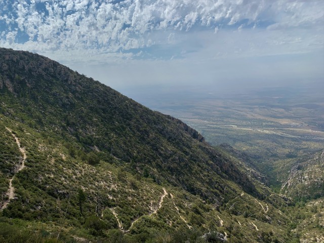
Bear Canyon trail turned out to be a serious workout. Frijole Ranch, where I parked the car, is located at 5,500 feet above sea level; the point where the Bear Canyon trail arrives at The Bowl is almost exactly 8,000 feet up. Much of that altitude gain takes place in the last 2 miles of the trail, and it was as tough of a hike as I have ever done, anywhere (including the Himalayas!). Canyon Wrens taunted me all the way up, and a pair of Cordilleran Flycatchers gave great views in a shaded, rocky gully.
For birders, The Bowl is a kind of fairytale wonderland where it feels like anything can turn up. It is a unique habitat in Texas and also – due to the difficulty of access – one that is rarely visited by birders. There is a real sense that discoveries can still be made up here. It’s a gorgeous place, with the fragrant pines providing shade and the high altitude making for temperatures in the low to mid 70s – even on a July afternoon when the valleys and deserts far below swelter at over 100 degrees.
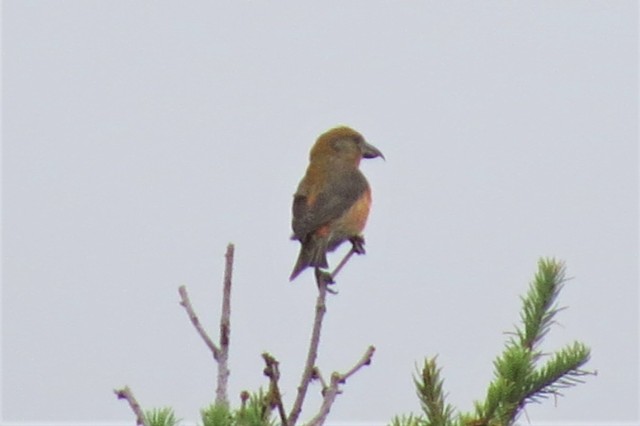
Birding was slow at first, until I discovered an area with lot of bird activity, along the trail downhill from the rusty water tank ….. basically a right turn then a left turn from the top of the Bear Canyon trail. The highlight was a flock of 5 Red Crossbills, likely a very scarce resident bird up here but seldom seen (my sighting was the first record of this species anywhere in the Guadalupes this year).
I also enjoyed views of Audubon’s Yellow-rumped, Grace’s, and Virginia Warblers, and several species that in other areas of Texas are usually only available in winter: Brown Creeper, Dark-eyed Junco, Hermit Thrush, and Spotted Towhee.
With dark clouds building, and distant rumbles of thunder, I had to cut short my wandering in The Bowl and start making my way down. Getting caught in a thunderstorm on the exposed reaches of the Bear Canyon trail would have been no joke – dangerous even! – and fortunately I got back to the car before the storm got too close. It took just an hour to get down, compared to almost three hours going up!
Day Five:
I overnighted near Van Horn – thankfully, evening storms kept the temperatures unseasonably low – and before dawn I was checking out the area near Culberson County airport for year list targets Gambel’s Quail, Crissal Thrasher, and Black-tailed Gnatcatcher. The quail proved to be easy to find (and completed my sweep of all three Texas quails seen and photographed in 2019), but I drew a blank with the gnatcatcher and thrasher here. However, the Black-tailed Gnatcatcher made it onto my list a little later, thanks to an opportune roadside stop at a washout on the road towards Marfa …. the habitat looked good for this species and my hunch proved to be correct!
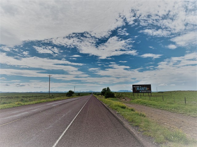
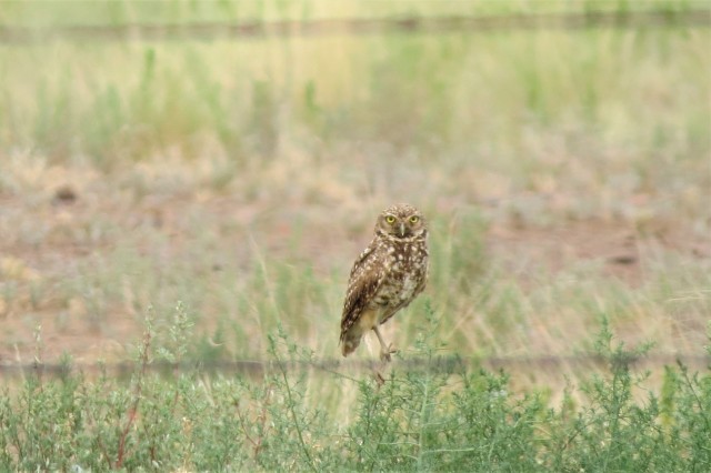
Two out of three isn’t bad, and I continued towards Marfa, grabbing some Presidio county ticks beside the road including Burrowing Owl, Swainson’s Hawk, and Curve-billed Thrasher.
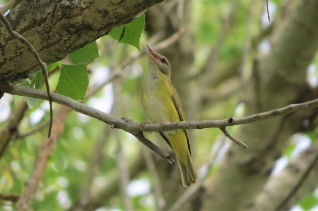
The reason for the detour (and scenic drive) was to take in the long-staying Yellow-green Vireo, which has been singing its heart out in a riverside park near Marathon all summer. This attractive vireo is normally a rare passage migrant on the Texas coast; a summering bird is very unusual. As soon as I arrived at the site and opened the car door, I could hear the bird singing very loudly, and it took just a few seconds to locate.
After that, I hit the road back to New Braunfels, and the following morning to Houston. It’s a long, long way back from west Texas, but somehow the drive never seems too bad …. the speed limit on i10 along here is 80mph, and traffic is always very light, so the miles get eaten up pretty fast.
Logistics:
A four-wheel drive vehicle is not necessary for this trip – there is very little off-road or even dirt-road driving involved. With that said, my Subaru Outback is probably the perfect vehicle for this kind of adventure, with plenty of luggage storage in the back – and the reassurance of high ground clearance and 4WD should it become necessary!
One challenge on long trips like this is eating healthily. Rural Texas is not renowned for healthy roadside eating options – and indeed, in remote areas in the Guadalupes, there is no food available for purchase at all.
I figured that even in my “Coolest” cooler, ice would probably not last for 5 days in July, so I packed only foods that did not need to be kept cool. My healthy pantry contained the following:
- Heather’s Choice freeze-dried meals (grass-fed bison chili, Sockeye Salmon chowder, and African Peanut Stew varieties – all of which were delicious).
- RX Bars
- Larabars
- Organic apples
- Natural organic peanut butter
- Nature’s Choice gluten free crackers
- Bumblebee tuna sachets (various flavors)
- Organic oats
- Single-serving Tetrapaks of organic milk (I would have preferred coconut milk or almond milk, but I couldn’t find any small sizes in the store and it was too late to order online).
- Trail mix (raisins, cashews, almonds and walnuts)
- Three one-gallon water containers (drinking water for refills is available at Dog Canyon, as well as other trailheads in the Guadalupes).
- Freshly ground Bulletproof coffee, with Bulletproof instamix.
- Small saucepan
- Aero Press coffee maker.
This was the first outing for my new North Face 2-person tent and my Coleman camping stove – both of which were excellent.
I ended the trip on 398 bird species in Texas in 2019 so far …. already ahead of my entire total of 384 for the whole of 2018.